Extent of prohibition
The consumption of liquor is prohibited and the possession of liquor is prohibited.
Period of prohibition
8 pm on each day to 6 am on the following day.
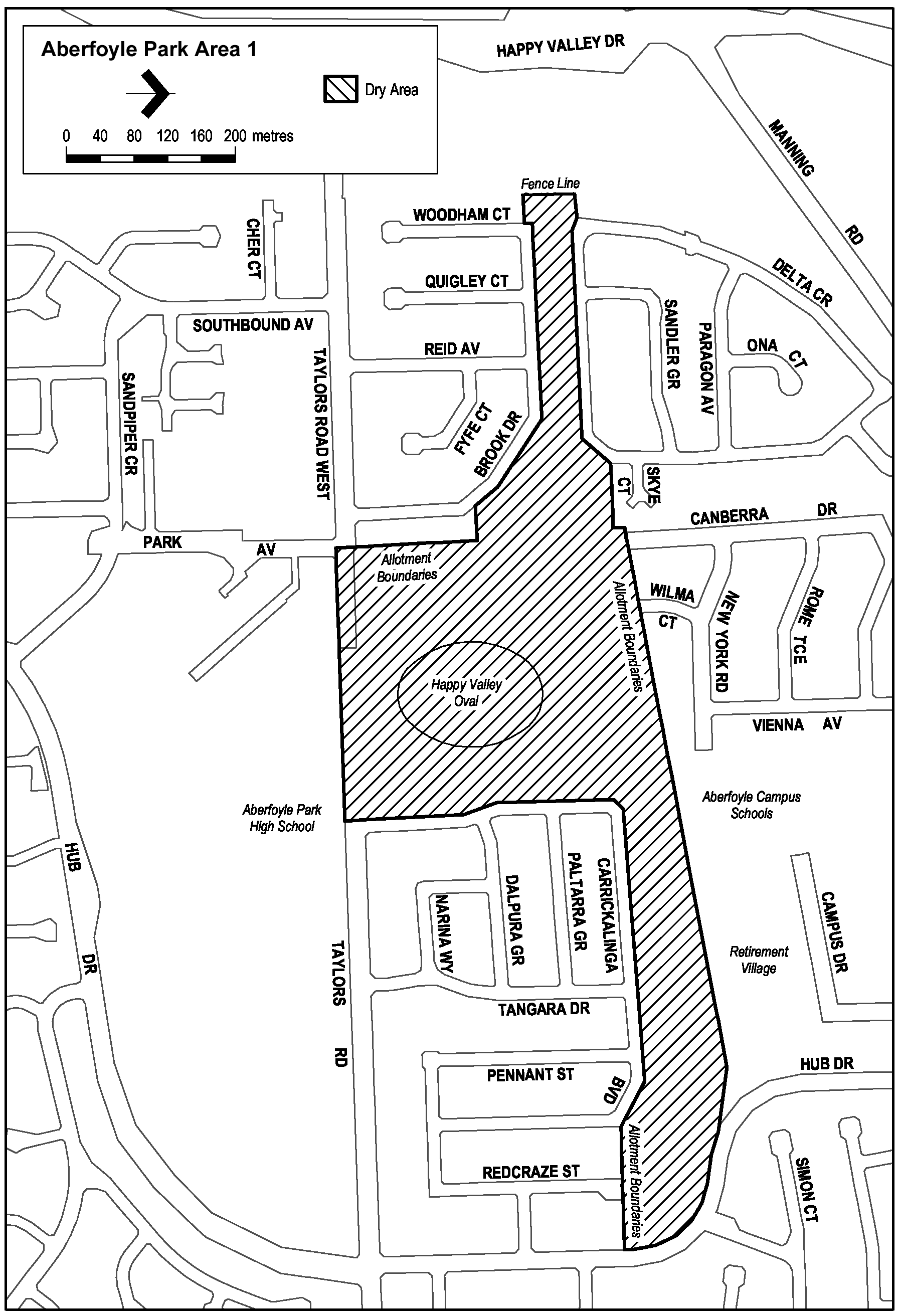
Description of area
Reserve area in Aberfoyle Park, as follows: commencing at the point at which the western boundary of Carrickalinga Boulevard, Aberfoyle Park, meets the southern boundary of Taylors Road, then westerly along the northern boundary of Aberfoyle Park High School and the Hub Sports Centre to the eastern boundary of Park Avenue, then northerly in a straight line across Taylors Road West to the south-eastern corner of the allotment of private land that lies on the corner of Taylors Road West and Brook Drive (on the northern side of Taylors Road West and on the eastern side of Brook Drive), then northerly along the eastern boundary of that allotment and the row of adjoining allotments to the north-eastern corner of the northernmost such allotment, then westerly along the northern boundary of that allotment to Brook Drive, then north-westerly and westerly along the northern boundary of Brook Drive to the northern boundary of the next allotment of private land that adjoins that boundary of Brook Drive (being an allotment joining the western end of Brook Drive), then westerly along the northern boundary of that allotment to the north-western corner of that allotment, then northerly along the fence line that crosses the creek that lies to the north of the allotment to the south-western corner of the southernmost allotment adjoining the western boundary of the westernmost portion of Delta Crescent, then easterly and north-easterly along the southern boundary of that allotment and of Delta Crescent to the south-western corner of the next allotment of private land adjoining that same boundary of Delta Crescent, then generally easterly and north-easterly along the southern boundaries of that allotment and all adjoining allotments of private land (and of Canberra Drive and Wilma Court) to the southern boundary of the Aberfoyle Campus Schools, then north-easterly and easterly along that southern boundary and the southern boundaries of the adjoining allotments of private land (the boundaries approximately indicated by a fence and then by a pathway) to the western boundary of Hub Drive, then south-easterly and southerly along the western boundary of Hub Drive to the north-eastern corner of the next allotment of private land adjoining that western boundary of Hub Drive, then westerly along the northern boundaries of that allotment and all adjoining allotments of private land (and of Redcraze Street) to the eastern boundary of Carrickalinga Boulevard, then north-westerly, westerly and southerly along the road boundary on that side of Carrickalinga Boulevard to the point of commencement.
Map of area